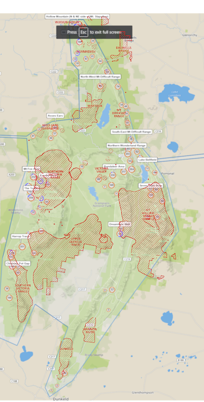
Here are the updated permitted area maps as released by PV in Dec 2021. To make it just slightly less tedious; here’s the overview map, and the corresponding download links (direct from SGC). If a climbing area is not on these maps, it could be banned crag, or a crag yet to be assessed. Please see the GGLMP post for more info.
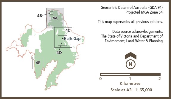
SPA MAPS – 2019-2021
Below is are the maps showing ‘Special Protection Areas’ in the previous (pre 2022) management plan.
Click the maps for the full sized versions. You can see the original PDF from parks here. The full list of affected crags is on the Closed Areas Page. See further below for the overlay maps.
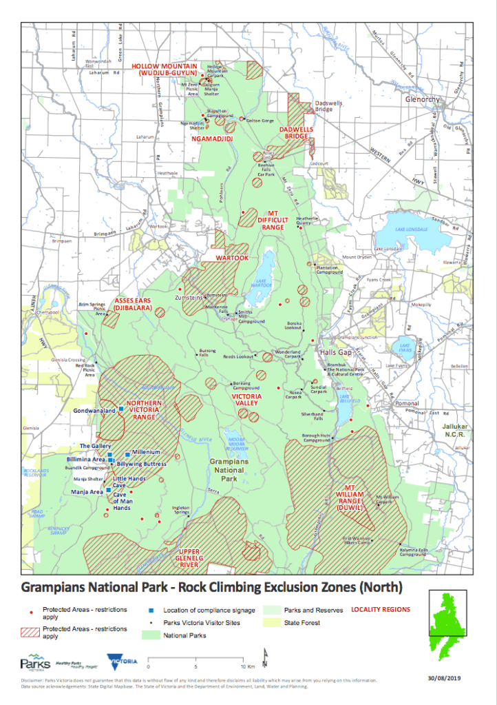

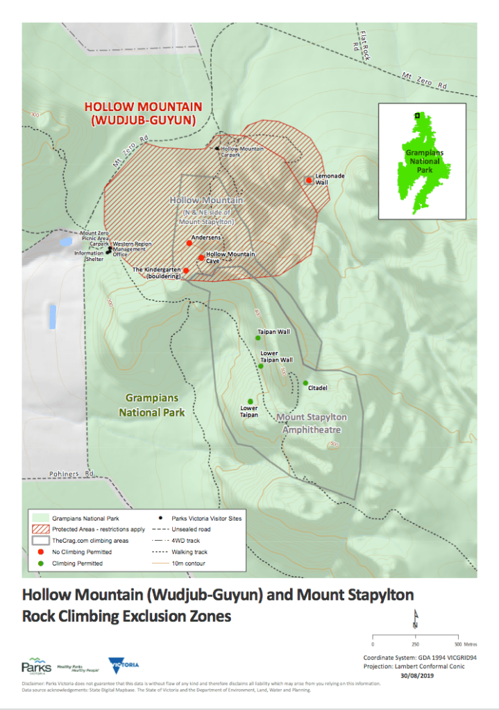
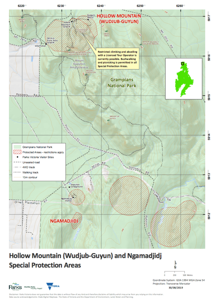
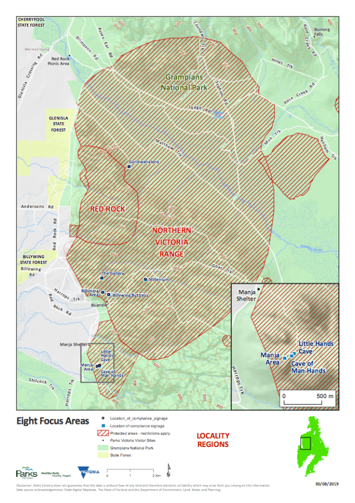
Parks Victoria have promised better maps and GPS co-ordinates but these have not yet materialized.
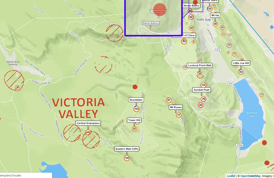
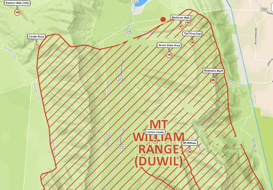
Overlay Maps
It is hard to make out which climbing areas have actually been impacted by the SPA regions, so some attempt has been made to overlay the maps above with location data from The Crag . Perhaps keep a copy of these on your phone, in case there’s any dispute about where you might be climbing; as some climbers have been told to leave areas that are NOT in SPA’s.
So please take them as a guide… and refer to the Closed Area Info page for updates on confirmed closures.

Also: Click here to go straight to the Grampians Map on The Crag.
