
We spent three days in the Northern Grampians last week to document some of the more popular climbing areas in and outside the banned Special Protection Areas and also re-visit some of the mainstream tourism walks and Aboriginal art sites. The aim was four-fold, 1) to record a snapshot in time of climbing & walking in the area, 2) try and document the condition of some of our favourite climbing areas through the eyes of a someone in government doing an “assessment”, 3) simulate the experience of a first time climbing visitor to the area who is not aware of the bans and lastly 4) to locate some of the Aboriginal cultural heritage in the area that has been mentioned in meetings with PV.
This will be a two part article, the first focuses on Hollow Mtn and the second will be on Stapylton. What he saw was good and bad, climbers impacts are certainly evident but not unique in their impacts. There is a long history of people visiting this area evident everywhere you look. What was clear is that, despite the bans, climbers are certainly the main users of the area during the week (when we visited). Tourists were few and far between compared to commercially led climbers in Summer Day Valley. This photo essay comes from 30th October to 1 November 2019.
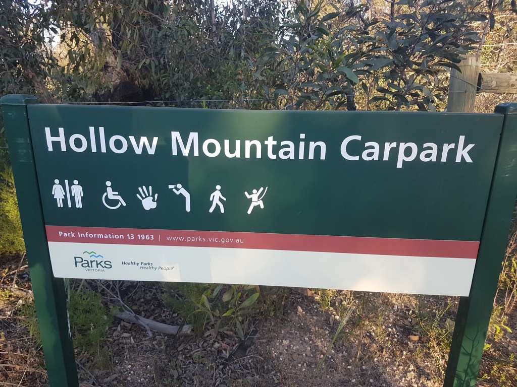
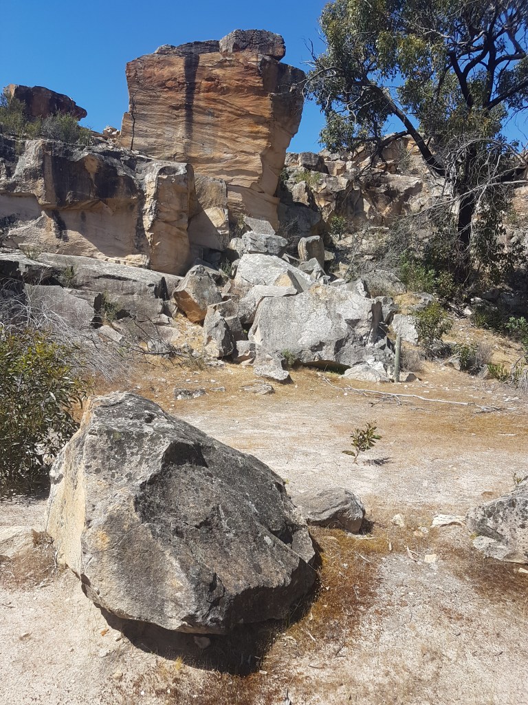
As most international or interstate climbers would do, we drove from Arapiles to the Grampians. It was hot, really hot. 36’C when we pulled into Hollow Mountain Carpark at 2pm on a Tuesday. It could easily fit 50 cars and several tour buses, but instead it was completely empty apart from one lone mini bus baking in the sun. A read of the glossy Parks Victoria interpretative signs didn’t reveal any messaging about the SPA climbing bans that cover the majority of climbing accessible from this carpark. If there were bans they certainly weren’t making an effort to advertise this. The only sign of trouble was an attempt to black-out the word Hollow Mountain with a Sharpie.
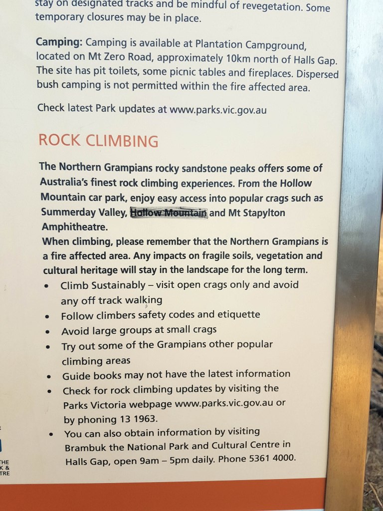
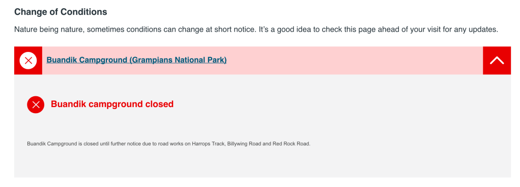
We did as their sign suggested and logged on to Parks Victoria’s website to see if there was any updates about climbing (a struggle with poor mobile reception). Again there was no information readily available. The only “need to know” they listed for the entire Grampians was the closure of Buandik Campground – entirely irrelevant. The dedicated Northern Grampians page doesn’t even mention rock-climbing despite it being home to Taipan Wall and numerous other world-famous climbing areas. It’s like they want to pretend climbing does not exist. Later in this article we will talk about our impression that the majority of people visiting this area mid-week were climbers, on the three day trip we were there it was easily a ratio of 10:1 climbers to non-climbers. So this lack of info was concerning.
The planned first stop was a walk up to Gulgurn Manja rock art shelter, one of the six “caged” art shelters in the Grampians region. On the way up to this cave the tourist track passes an abandoned and unsignposted rock quarry that until 1998 was the main campground for climbers and bushwalkers in the Northern Grampians. This quarry was one of the major sources of stone used for important buildings in Melbourne last century. Presumably thousands of tonnes of stone were removed from this site to create the bowl that was the old campground. Of interest is the proximity to both the art site and Summer Day Valley – it would be less than 50m from each. It would be nice to have an official sign about the history of this quarry – it’s currently overgrown and hidden.
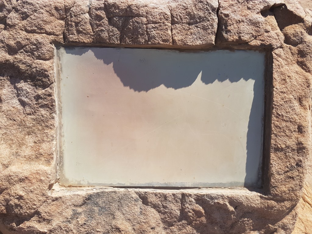
As we continued on the tourist track to the art-site it was clear any interpretative signage had been nuked in the 2014 fires but had not been replaced. This is a shameful state of affairs. We desperately wanted to learn more about the art-site and Aboriginal heritage but the signs were completely faded and unreadable. In the era of millions being spent on a Grampians Peaks Trail couldn’t they spare a few thousand to re-print these signs? Luckily we had purchased an excellent book “The People of Gariwerd” in advance which gave us some good background info and is highly recommended for anyone interested in Grampians history.
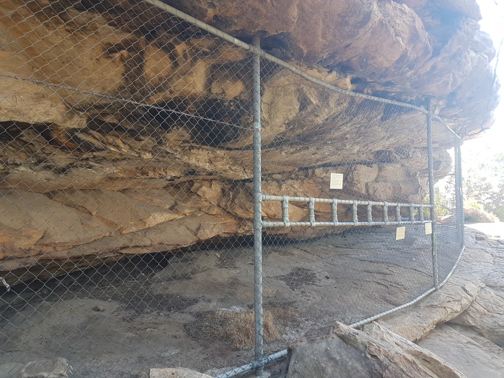
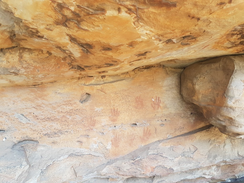
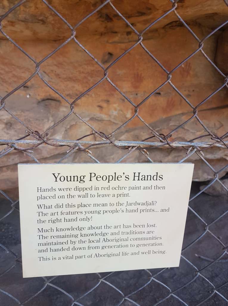
A visit to sites such as this is a valuable educational experience for climbers. It’s a shame this particular site doesn’t seem to be getting much love in recent years from Parks Victoria. The cage is an unappealing structure from the 70s that could well do with a refresh like the one at Stapylton Campground. New signage is certainly required.
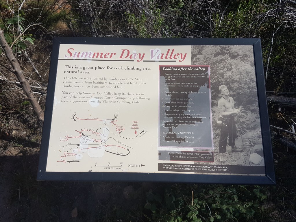
Summer Day Valley
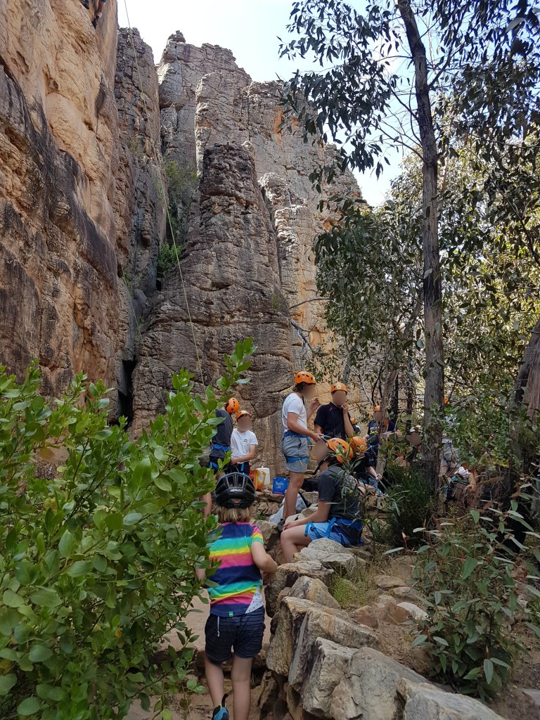
Next day was a visit to Summer Day Valley, an area at the heart of the climbing ban issues. For more than 40 years it was the Grampians most popular climbing area due to the very short approach, good trad protection, top-rope accessible and multiple wall directions allowing all day shade or sun as required. Since February 2019 it has been shut to recreational climbers because it is inside a Special Protection Area where climbing is prohibited according to PV. Summer Day has also been a popular commercial guiding venue over the last couple of decades, and these operators have been allowed to continue working in SDV despite the ban. To keep access they have to follow new strict requirements including pre-booking sections of the crag with PV, on site signage and cultural inductions. We were keen to check out these inductions in person but unfortunately, at the last minute, these inductions were cancelled so we can not report on them (which was the main reason we were visiting).
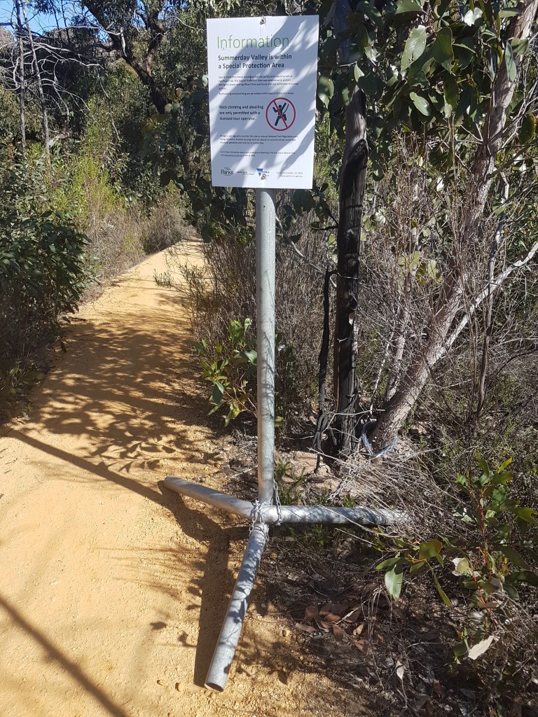
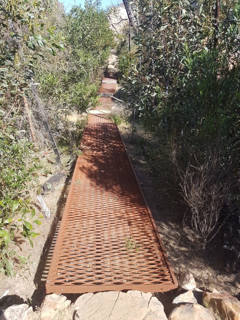
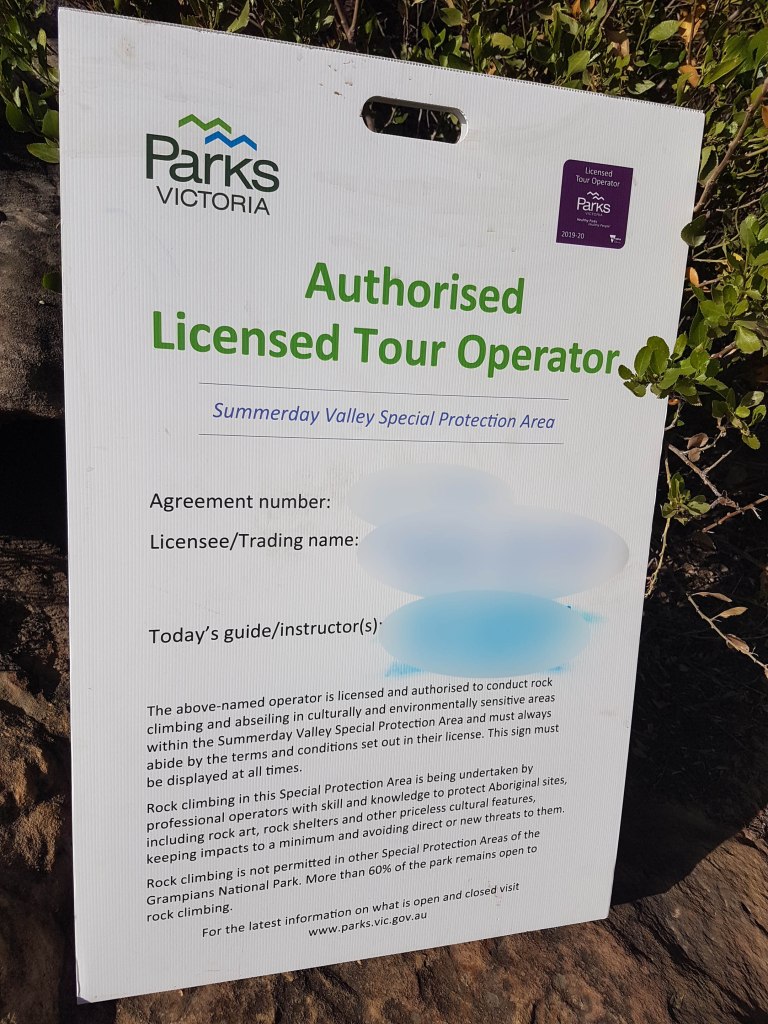
Summer Day Valley is approached by short 100m walk from the Hollow Mountain Carpark along a track built by Parks Victoria. The track was re-routed after the 2014 fires to keep it away from the creek-bed. The first thing you see is this sign chained to a tree explaining that “rock climbing and abseiling is only permitted with a licensed tour operator.”

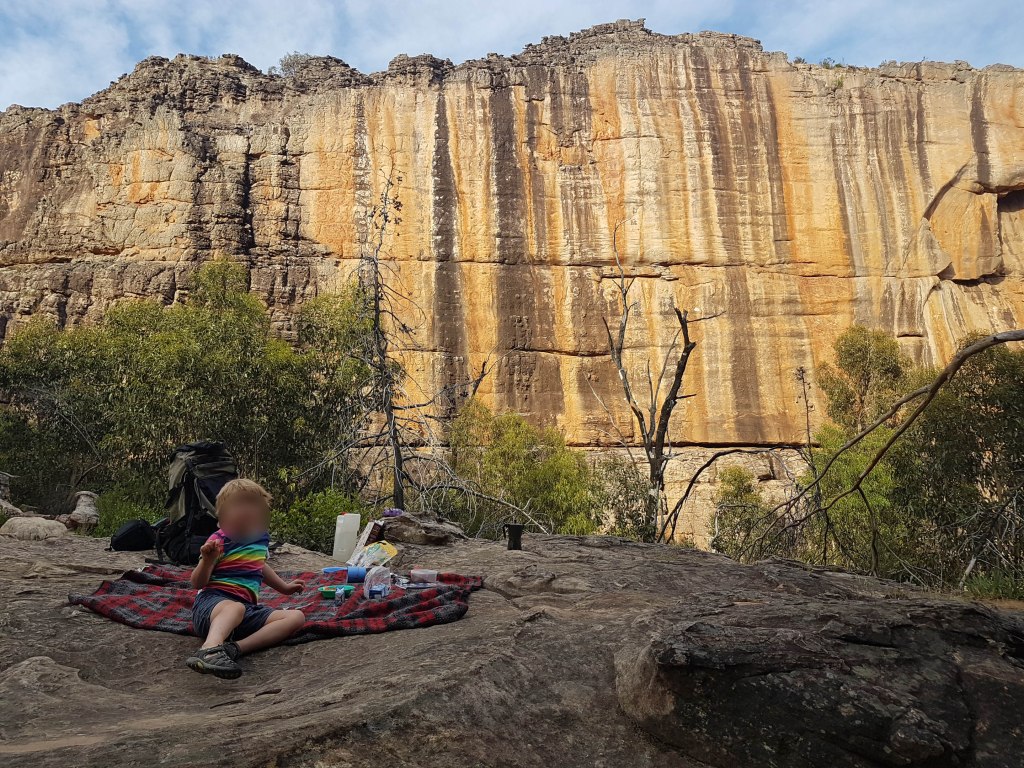
We were not part of a licensed tour – but it also says that “bushwalking and picnicking are permitted” so we made sure to pack our rug and breakfast.
It was still early, so we unfolded the legislated* picnic blanket on a nice rock platform and ate breakfast with the local wallabies. (*joke)
With time to kill we explored the complex area of SDV in detail as legislated* bushwalkers (*joke). We started with a walk around what is called Main Wall, which is confusing as it’s actually now on the backside of how you approach it – it was originally accessed by the quarry campground mentioned earlier. Climbing was actually shut on this wall way back in 2011 after large floods damaged the creek and allegedly exposed some cultural heritage items. This has never been confirmed by PV. For several years a flimsy laminated sign asked climbers to stay off the Main Wall routes but this sign disappeared a couple of years ago and has never been replaced. Many climbers presumed it had reopened when this sign went missing – and this led to much confusion. This was all prior to this years SPA ban announcements.
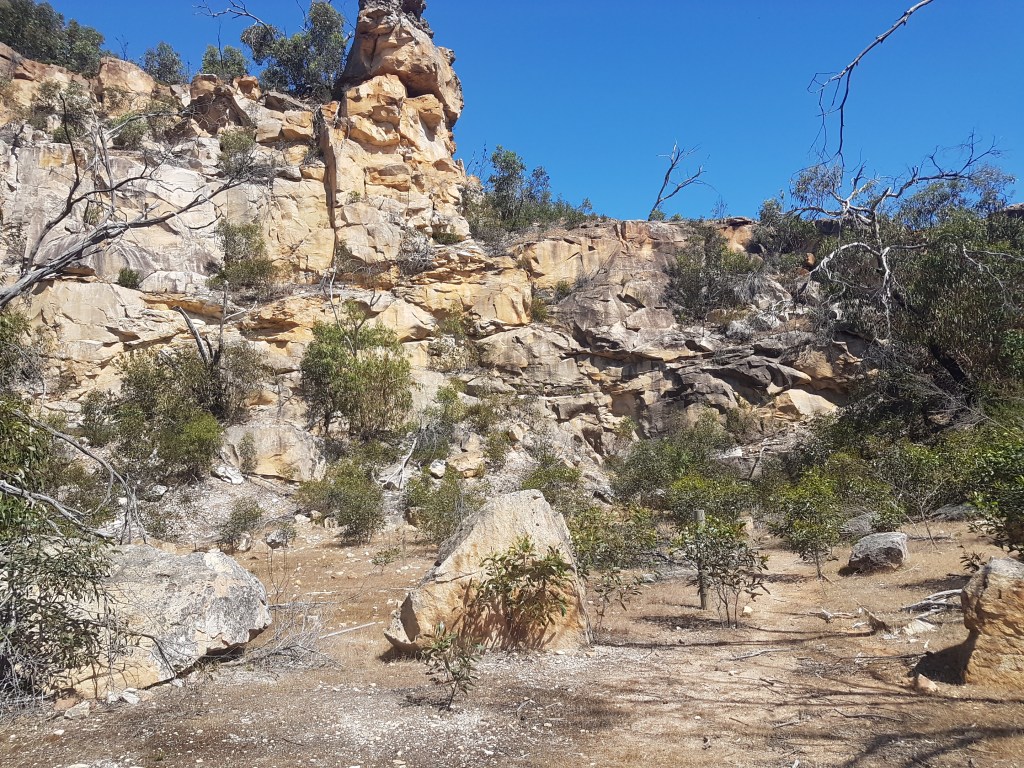
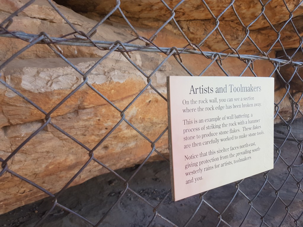
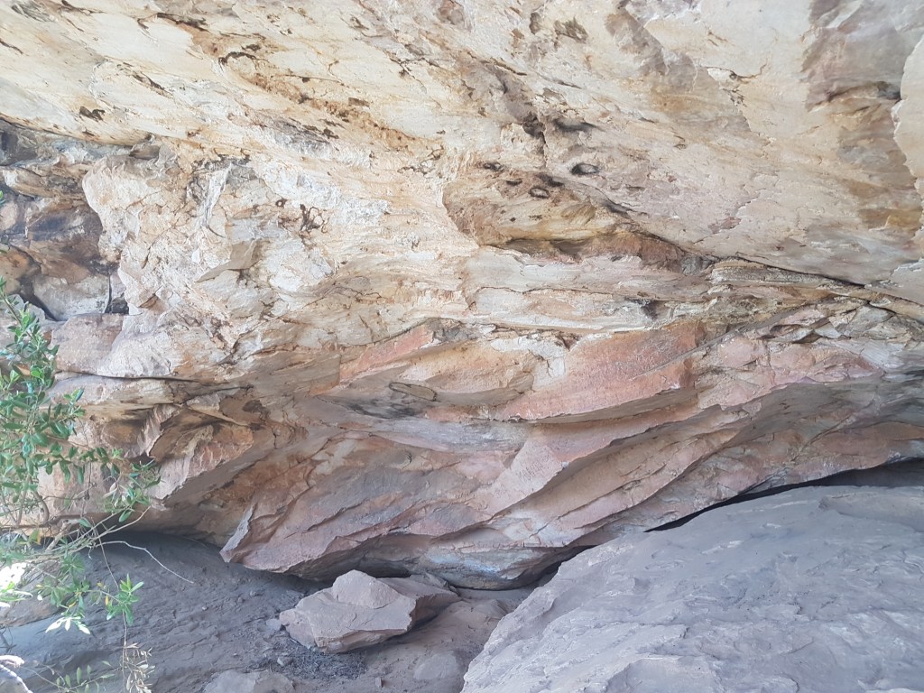
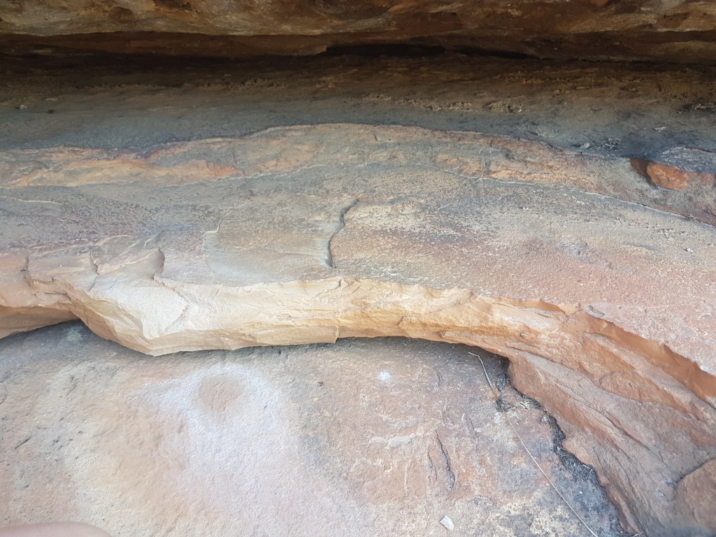
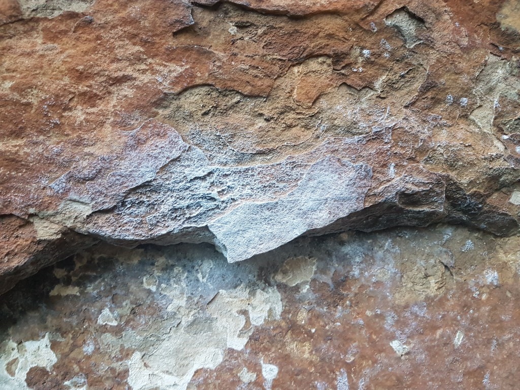
We then went for a walk to Wall of Fools to try and locate the Aboriginal stone tool quarry site that had been rumoured to exist there and has alledgely been one of the causes of the recent bans. None of the details are public knowledge and have ever been released officially. We only know about this from comments made by PV staff in meetings held in Halls Gap with tour guides. In general the rock on that wall is soft sandstone (thus the extreme weathering with the big jugs on the left and right sides) – but in the middle we did find some sections that appeared( to an untrained eye) to be the broken rock edges in question. There did not appear to have been directly impacted by climbers as they were at ground level and tucked under a small overhang.
School Groups Arrive
By 8am the first school groups started emerging into the valley, with guides starting to pop their heads over the cliff edge and throwing ropes down. There was a brief moment of yelling when one group was confused about who had booked which wall. The picnic book we were reading at the time summed it up rather well.
Jokes aside, there were three Licensed Tour Operator groups working inside the valley on Back Wall and left side of Wall of Fools, and apparently another group operating on the BARC cliff which we didn’t see. Each of these school groups consisted of 15 or so students and a couple of climbing guides. Doing a rough head count at lunch we think there was approximately 60 students and about 10 adults in total. At peak period there was about 15 top-ropes set-up on almost every available easy route.
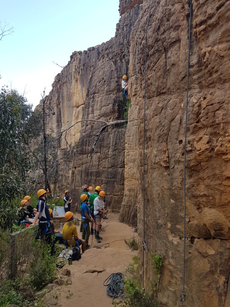
All the kids were well behaved and the stonework built by PV and CliffCare a decade ago really works to contain any erosion issues. As a beginner friendly place that can handle a lot of people Summer Day is hard to beat. We can see why the LTOs were desperate to keep access open at this area. When we asked one guide where was an equivalent place a “recreational” climber could go that had easy access for toproping they suggested Mountain Lion. We googled the distance – it is 85km away and more than an hours drive. Not exactly a solution. Another guide suggested The Watchtower near Halls Gap – but when we visited there it was a disaster of erosion and in our opinion should be shut to commercial groups until it recovers. Bushrangers Bluff at Arapiles is actually probably the best bet, but when went there the week before it was also busy with guiding companies. It is clear that there is now major pressure on limited climbing resources from the LTO industry.
Even if recreational climbers were allowed back into SDV the commercial LTO’s had a total monopoly of the easy routes for most of the day. Each LTO books a certain wall so they put top-ropes on every route in their section. If any of these restrictions do get relaxed then it would be well worth establishing how it would work if someone just wanted to go climbing as a pair rather than a large group.
We have been told this whole LTO only system is a temporary solution to a) protect cultural heritage b) keep the LTO businesses functioning. So far there has been no information given from PV about future changes to this system.
In general Summer Day Valley is in remarkably good condition thanks to the early pre-emptive work done on trails and belay platforms with stonework. The fencing off of the centre of the valley has also allowed superb regrowth of plants and it’s now hard to imagine the burnt out wasteland of only a few years ago. Hopefully this area can be reopened to recreational climbers in the future.
As a side note we were coincidentally in Summer Day when it hit the national press after local guide Tori Dunn was apparently prohibited from working in the Valley by PV and TOs. Have a read of these two articles in the Australian. Article 1 and Article 2. And this more local article in the Wimmera Times. This is a complex story with legal ramifications which we hope to write about in the future.
Hollow Mountain Track
To finish the day we took a walk up the tourist track to Sandinista Wall, across to Amnesty and through to the Andersen’s bouldering area. All these climbing sectors are in an SPA where climbing is prohibited according to PV. It has been 9 months since the bans were announced so it would be interesting to see what these areas would look like with a bit of “time off”.
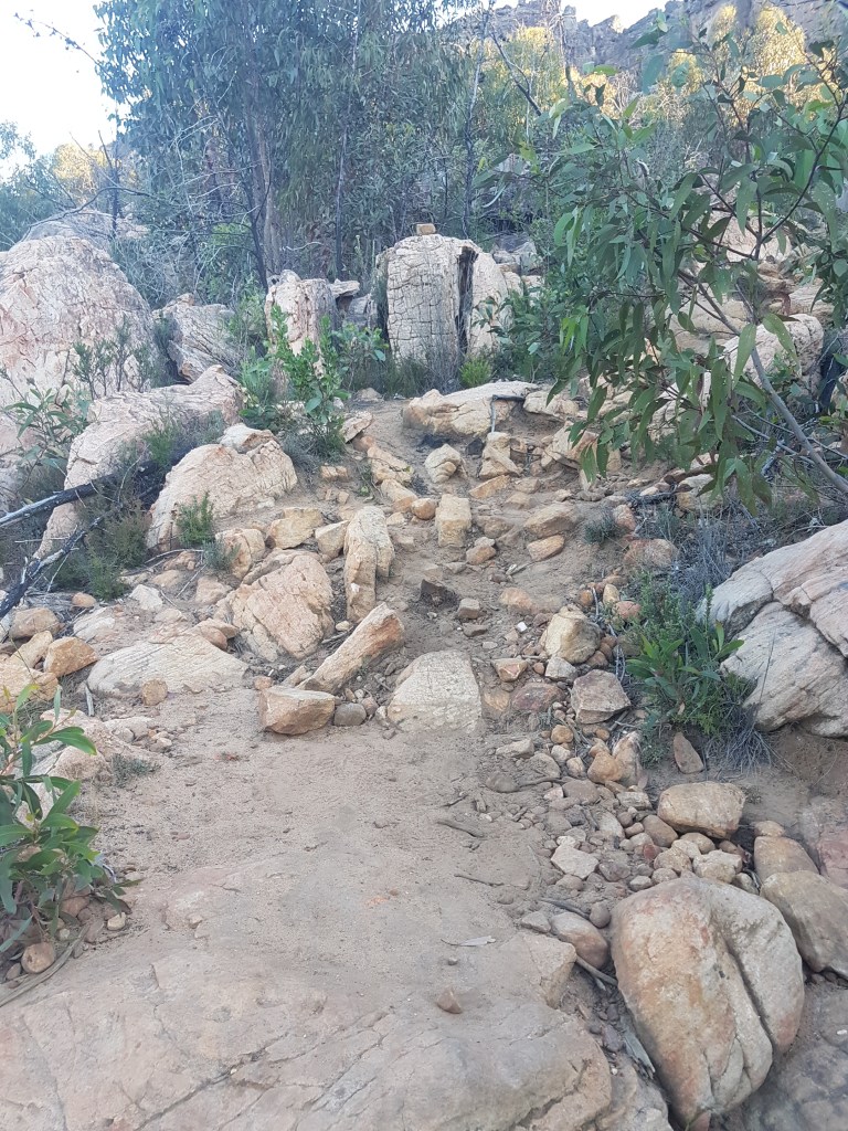
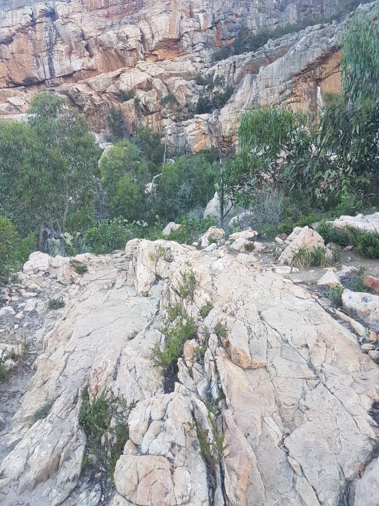
The tourist track was actually in poor condition once it starts heading steeply uphill. It was heavily eroded in places and braided into at least three independent tracks up near Sandanista Wall. This whole section was heavily damaged by the 2014 fires but PV has not made much of an effort to create or mark a proper path. The landscape was heavily damaged by the fires and lost tourists are certainly not adding to the rehabilitation of the area.
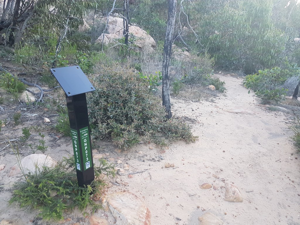
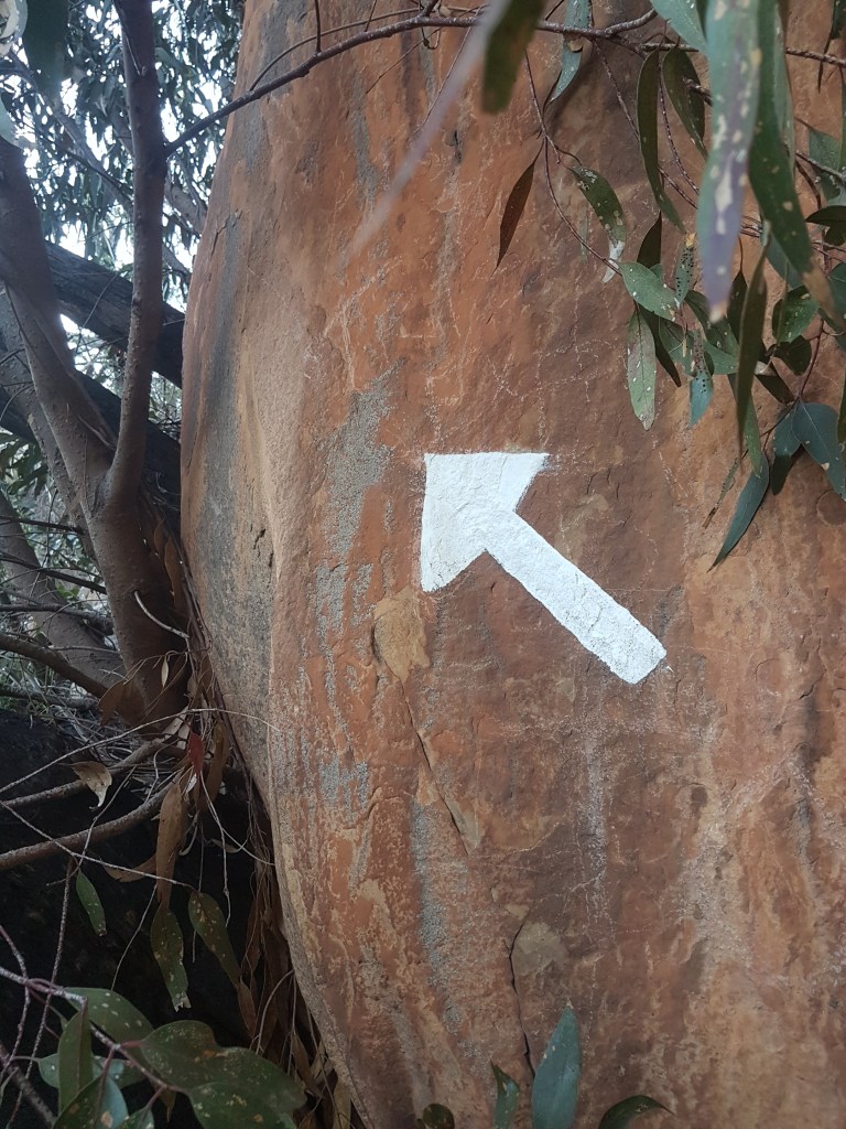
At the intersection of the tourist track and the climbers track to Andersens bouldering is the remains of the old official PV sign about bouldering. This was a positive and informative sign – now replaced with four empty bolt holes. If bouldering is indeed banned at Andersens – why have they not installed a replacement sign saying this? The climbers track is of equal size to the tourist track – it’s actually highly confusing about which way to walk for anyone just walking past.
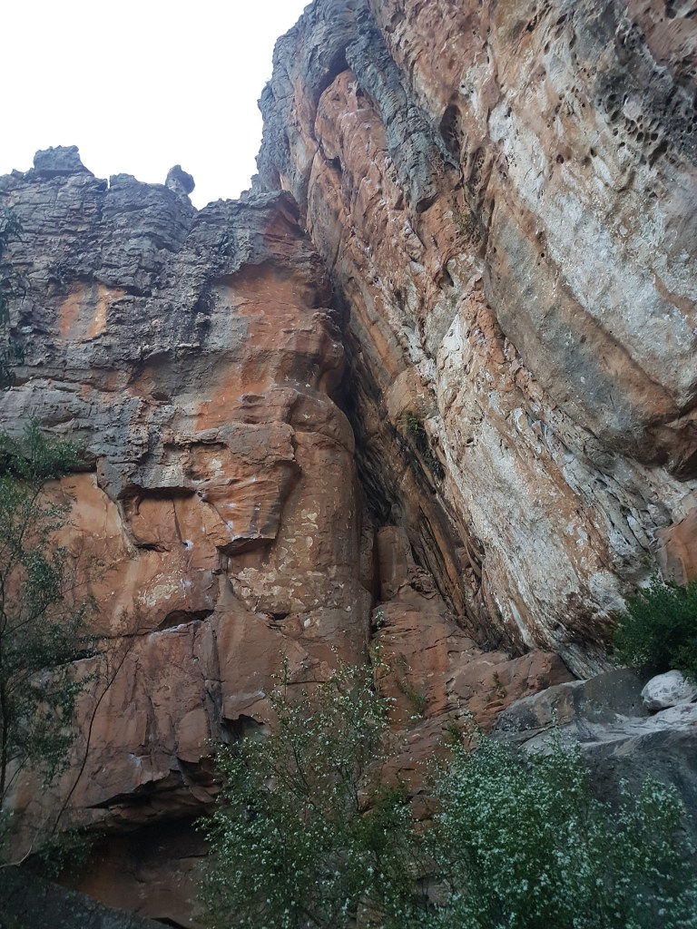
Sandinista Wall
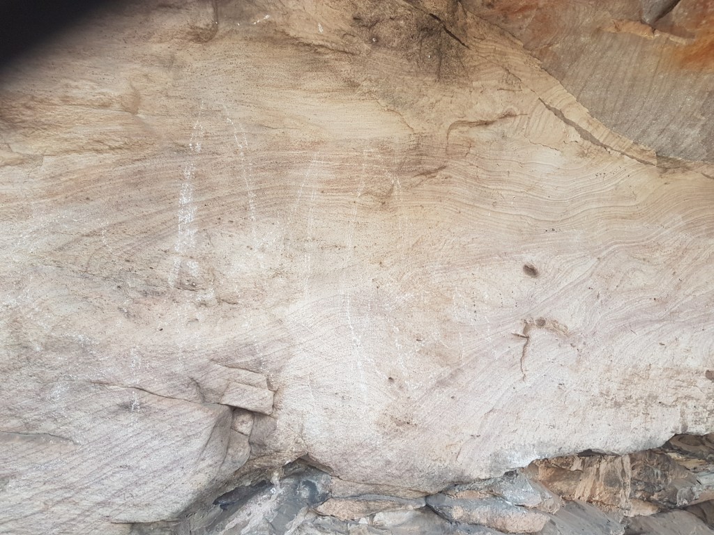
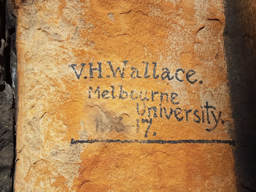
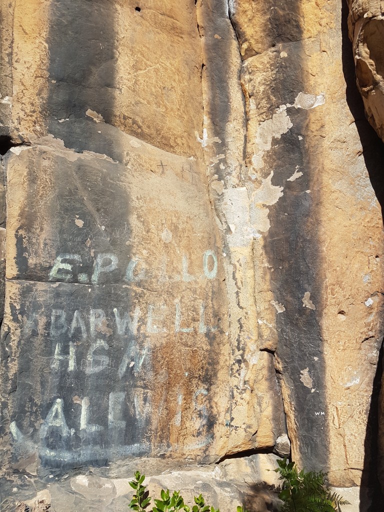
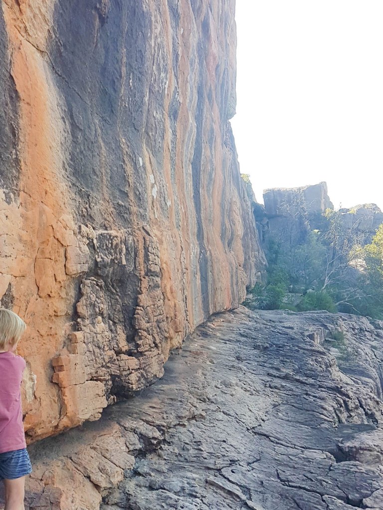
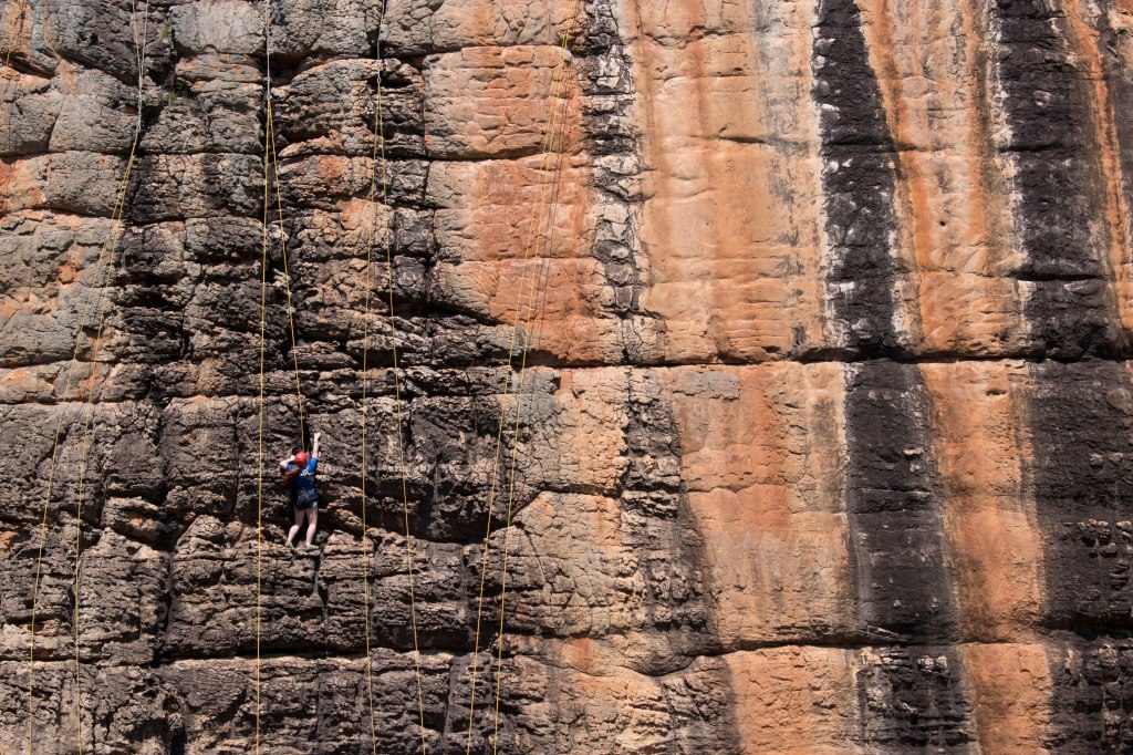
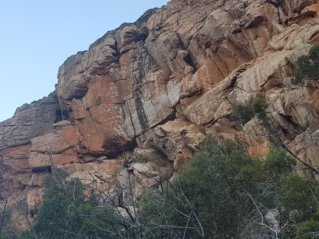
Sandinista Wall has always been the most public climbing area in the Grampians. The routes literally rise directly above the tourist track and half of them are safety bolt protected. Luckily for aesthetics the first bolts are quite high up and the wall is heavily featured so bolts are pretty invisible to the casual observer. Chalk is evident but it blends in with considerable bird poo streaks and leaching streaks of minerals on the wall. It is not an obvious eyesore. Along the base of the cliff, where the tourists congregate to catch their breath and look at the view, is potentially more Aboriginal quarry rock edges. Sandinista is home to several very famous routes – the first grade 30 in Australia outside of Arapiles for example. It will be an interesting test case if it could ever be reopened to climbing.
Amnesty Wall
Andersens
At this point the camera phone ran out of batteries, but we continued on to the Andersens boulder field in the dying light. It appeared to be in pretty good condition in general. Minimal erosion, just a few spots of bare dirt around the base of the major boulders. There was still quite a bit of chalk on the overhung problems that would be relatively easy to remove. Lots of greenery – the track was hard to follow in spots because it was so thick. In general we saw that Andersens seems to be able to handle quite heavy climbing traffic better than the nearby (open) Trackside. We will cover that area in part B. No sign of rubbish or toilet waste was evident.
Wrap Up
We have so many good memories spent on these cliffs with family and friends over the last few decades. Now the climbers are gone it has an almost eery museum like quality to the place. There are the remains of climbing still present, bolts and chalk stained rock, but not the people out enjoying themselves. It was hard to resist stepping off the ground and onto the rock. Where bushwalking ends and bouldering begins is an odd line to define in a place covered in rock like the Grampians.
In the two days we spent on the Hollow Mtn side of Stapylton we saw almost no tourists at all. It was a hot couple of days but we expected to see at least equal numbers of tourists to climbers. But this was not the case. By a huge majority the greatest number of visitors were climbing students in SDV. The rest of the place was seemingly abandoned with all but a handful of tourists slogging up to Hollow Mountain. We saw a couple of climbers returning from Van Diemen’s Land late one arvo but no sign of climbers in any of the SPA regions. It was midweek – the following Melb Cup long weekend was reportedly the inverse – no climbers present, and lots of tourists.
It was apparent that maintenance of the Hollow Mtn tourist track and informing climbers of the climbing “bans” is not the priority of PV at the moment – head office is 30km down south and they have a lot more tourists to deal with closer to Halls Gap perhaps? It would be good at least for them to update some of the signage if indeed there really is a ban. At the moment a visiting climber could go climbing anywhere in the Hollow Mtn SPA (outside of Summer Day) and be totally unaware of any problems.
We highly recommend all the keyboard warriors get out and about and have a look at these SPA areas in person. You don’t have to climb – just pack a picnic blanket and sense of adventure.
Part B of this series will cover the Stapylton Amphitheater and Campground area and will hopefully be published in the next week.

We walked up to Hollow Mountain a month or so ago. Had a visitor from the US who hikes and climbs, had to stick to hiking that morning due to rain.
Your comment “Where bushwalking ends and bouldering begins is an odd line to define…” really resonates. As you follow the tourist track from the base of Sandanista up towards the summit of Hollow Mountain with rock under foot and overhead it feels a lot like climbing.
LikeLike